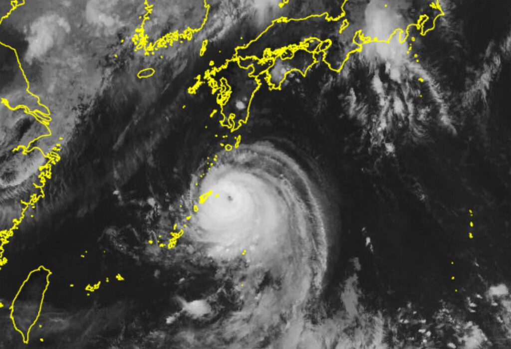


TOKYO: Typhoon Shanshan finished crossing the northern part of the Kyushu southwestern Japan region and reached the Seto Inland Sea on Friday morning.
The typhoon, which made landfall in Kyushu’s Kagoshima Prefecture on Thursday morning, brought heavy rain not only to Kyushu and the nearby Chugoku and Shikoku western regions but also to the Kinki western, Tokai central and Kanto eastern regions.
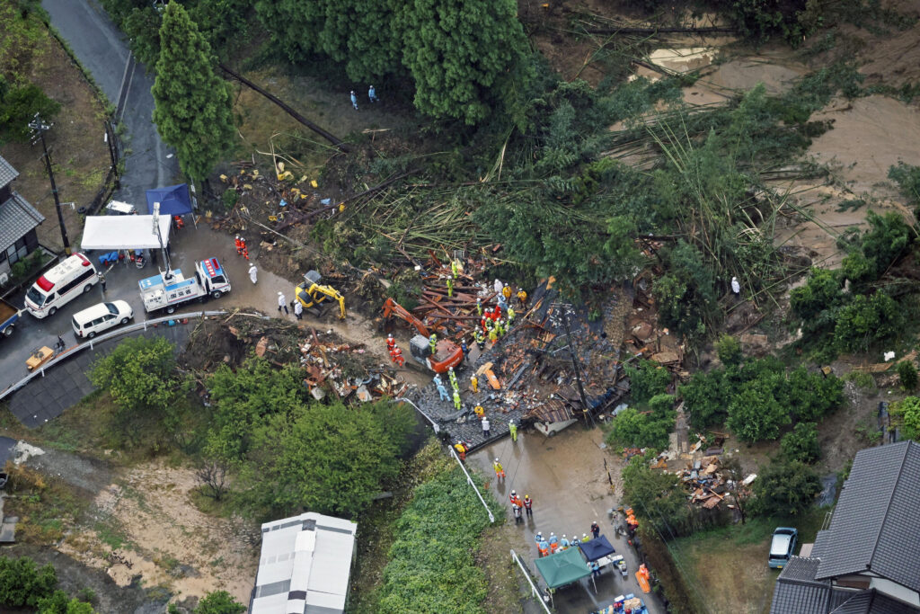
The Japan Meteorological Agency has urged people to be on high alert for possible landslide disasters, inundation and river flooding.
The slow-moving 10th typhoon of the year was traveling northeast at a speed of 15 kilometers per hour in waters near the Kyushu city of Kunisaki, Oita Prefecture, at 11 a.m. Friday.
With a central atmospheric pressure of 994 hectopascals, the typhoon had a maximum sustained wind speed of 20 meters per second and a maximum instantaneous wind speed of 30 meters per second.
It is forecast to travel east to around Shikoku by Saturday and turn into a tropical cyclone around Kinki by Sunday morning.
The Tokyo city of Hachioji in Kanto marked a record rainfall of 203 millimeters in the six hours until 12:20 a.m. Friday, while the 24-hour rainfall until 7:30 a.m. came to a record 474 millimeters in Kokuraminami Ward in the Kyushu city of Kitakyushu, Fukuoka Prefecture.
The city of Kawagoe, Saitama Prefecture, and the town of Ninomiya, Kanagawa Prefecture, both in Kanto, were issued calls for emergency safety measures, the highest level in Japan’s five-tier emergency alert system for weather-related disasters, temporarily on Friday.
The land ministry said that it had conducted preflood water releases at 136 dams as of 5 a.m. Friday to prepare for heavy rain brought on by the typhoon. The figure marked a record high, exceeding the previous high of 129 locations at the time of Typhoon Nanmadol in 2022.
JIJI Press