- ARAB NEWS
- 11 Jul 2025
Since 1975


Tokyo,
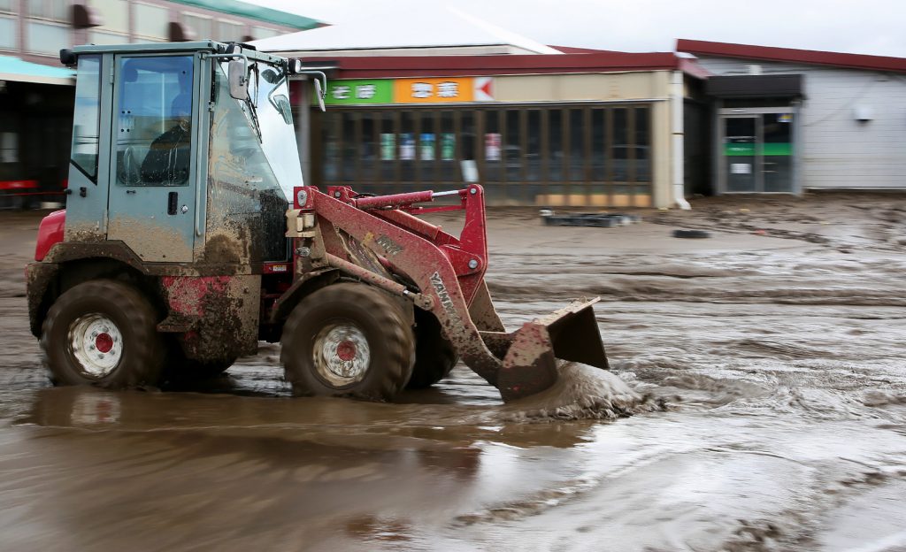
Japan's land ministry has urged all prefectures and municipalities in a notice to work on creating hazard maps for floods from inland waters, as many areas in the country were hit with such flooding caused by typhoons in September and October, according to informed sources.
The ministry plans to support the local governments by using a guide released in 2009 on how to create such maps, in addition to helping them draw conventional flood hazard maps, which show areas that may be affected by flooding of rivers, the sources told Jiji Press.
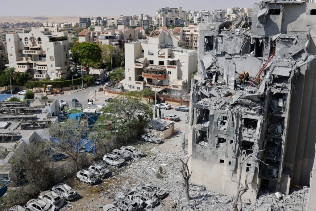
When the typhoons hit Japan this autumn, many places were devastated by flooding in which river water flowed over the levees.
Other areas faced inland flooding after the amount of rainwater exceeded the drainage capacity of ditches, sewers and other facilities, with roads and buildings becoming inundated also due to the overflowing of small rivers located in inner-dike areas.
According to the ministry, Typhoon Hagibis, which struck Japan in October, was responsible for inland flooding in some 150 locations in the country.
Inundation due to floods from inland waters, which happens within a short span of time, occurs more frequently than that from river flooding.
Areas prone to be hit by inland flooding usually differ from those highlighted in river flooding hazard maps, as inland flooding can occur in locations that are far away from rivers.
Inland flooding hazard maps have already been created and released by some 360 of 484 cities, wards, towns and villages for which the ministry considers an early creation of such maps crucial partly because they have suffered from major flooding in the past.
In response to the extensive flooding damage caused by the recent typhoons, the ministry, in its notice, called for the creation of inland flooding hazard maps also by municipalities that have never been hit by flooding.
The ministry asked municipalities that have already created such maps to review them to more adequately show areas that could be subject to flooding.
Jiji Press